Aerial Arts
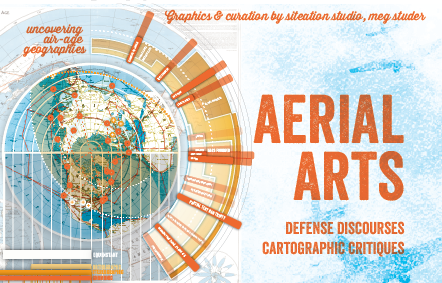
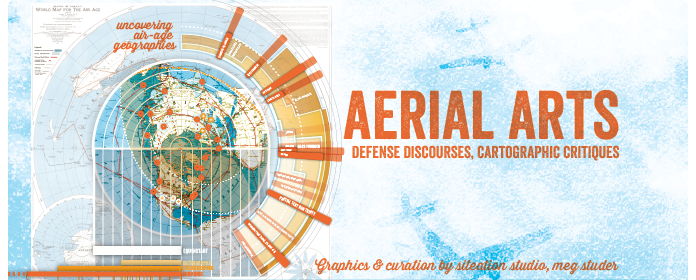
This exhibit explores Air-Age cartography, Arctic geopolitics, and their critique in 60s post-minimal art.
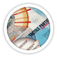
Infographic boards and mid-century maps chart the polar projections, oblique 'over-views,' and immersive maps shared between (civil) defense discourses and the 'Aerial Arts' of Robert Smithson, Walter de Maria, et. al.
In drawing out cartographic responses to the space and arms races, this show traverses a moment of global, intimate, and militarized mapping that resonates with our own.

Whole Earth Catalogs
The global imagery of the 'blue marble,' Whole Earth (Catalog), and Apollo 8 is familiar today. They are enduring environmental icons, and yet, they arose from and responded to a complex milieu of aerial maps and early remote sensing. This show explores how contemporaneous artists captured and contested the 'space age' convergence of global imagination and individuating media in their own way. It unpacks the shared sources and divergent appropriations of Robert Smithson, Walter De Maria, and others.

Cartographic Consumption
Cartographic production and consumption exploded during WWII. Along with traditional atlases, the popular press adopted novel projections, ‘global’ games, and oblique overviews that emphasized both the pilot's position and strategic, aerial warfare. Key to propaganda campaigns, these Air-Age maps were meant to both convince audiences of their inevitable (aerial) entanglement in the war and offer graphic means to trace out shifting territories from their homefront position.

Defense Discourses
From WWII through the late 1950s, polar maps were the choosen 'flight-oriented' format for both provoking anxiety over (atomic) attack and providing compensatory, concrete engagement. The visually condensed distances of flight helped with the popular promotion of Arctic radar defense lines (in advance of inter-continential ballistic missiles) while the mapping lessons of grade-school aerial orientation were seen to provide tactile engagement and inspire civil aeronautics and civil defense participation.

De-constructive collage
About a decade later, during the height of the space and atomic arms race (1966-69), the land-artist Robert Smithson began promoting 'Aerial Art' in articles and exhibitions. His map and aerial collages critically mimick the rhetoric, orientation instruments, and constructive map engagements of Air-Age polar projection. His explicit and deliberate conflation of 1940s and 1960s citations mocked both space race rhetoric and the bracketed phenomenology of modern and minimalist art.

Distortions & Debris
Beyond 'pop' appropriation and institutional critique, Smithson's forms drew directly, materially from militarized aerial apperception. His Infra-Perspectives collapsed polar-cartography grids with perspectival projections of flight. Likewise in Non-Site #1, Smithson sampled sand from the Coyle Field (NJ) target range. The Non-Site's indecipherable alliance of bombing debris and maps inverted the immediate, propagandistic association between Air-Age cartography and imminent attack.

Institutional Immersions
In advance of Smithson's de-constructive gallery demonstrations, many ‘aerial’ exhibition tactics were largely shared between museums and civil defense training. For example, MoMA's Airways to Peace(1943) offered immersive maps, ‘aerial’ models, and airplane recognition graphics that grounded 1950s deterrence demonstrations. Their conflation of cartographic and corporeal address formed the horizon of Cold War spatial consciousness.
satellite reception
What ultimately attracted artists' comment was the amazing resurgence of 'aerial' press in the mid-1960s, both cartographic and photographic. For the technically inclined, IBM shows (Mathematica, Astronomia) opened in 1964, conincident with cartographic reprints and DIY satellite reception kits. The 1967 release of Gemini astronaut photography spurred a number of glossy, terrestrial, aerial books. Although less vocal about satellites than manned expeditions, the media's visual narrative of tech-triumph, pilot's position (and global control) was eerily, ironically similar to that of the Air-Age; they offered a pastiche of those repressed references parading as progress.

raster erasures
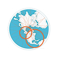
Although in conversation with Smithson, Walter de Maria's aerial imaging focused on the internal, technical limits of satellite photography. His Three Continents Project proposed to make three cuts in the deserts of Algeria, India, and the US, capture them by satellite and then collage their documents together. In choosing Gemini sites and a 1 mile cut, at the edge of raster invisibiblity, his collaged scans played on the conflation of manned and machine photography, offering the opposite of Whole Earth views: the pieced, partial, and grainy nature of global vision.
- 10/01/2013

aeriality
Director, Center for Art + Environment @ Nevada Museum of Art
- 10/10/2013
aerial arts opening
a fly through
Designer, Curator @ Siteations Studio
- 10/16/2013
Reconsidering Reconnaissance
camouflaging camouflage
Assistant Professor of Landscape @ Harvard GSD
Aerial view in the age of paranoia
Architectural Critic & Historian @ Princeton SOA
- 10/22/2013
the praxis of remote sensing
[title tbd]
Director, Spatial Info Design Lab @ Columbia GSAPP
Signal to noise
Architect, Partner @ Situ Studio
- 10/24/2013
Post-Blitz London: Redundancy & Erasures
Associate Professor of Architecture @ Penn Design
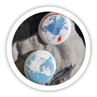
Air-Age Badges . Drone Decks (Aircraft Recognition) . Prints
We’re covering some production costs with Kickstarter. Please help make these cartographies and conversations a success!